GPXSee App Introduction
Introduction
GPXSee is an exceptional application designed specifically for Mac users. It offers a comprehensive set of features that enable users to view and analyze GPS-recorded routes with ease.
Supported File Formats
GPXSee supports a wide range of file formats including GPX, TCX, FIT, KML, IGC, CUP, NMEA, SIGMA SLF, Suunto SML, LOC, OziExplorer (PLT, RTE, WPT), GeoJSON, Garmin GPI&CSV, TomTom OV2&ITN, ONmove OMD/GHP, and TwoNav (TRK, RTE, WPT). This extensive support ensures that users can import and work with their existing GPS data seamlessly.
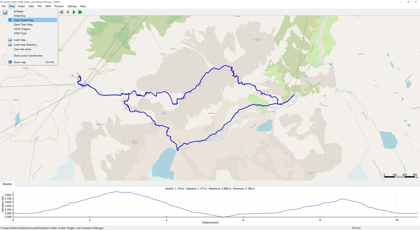
Mapping Options
When opening a route, users have the flexibility to choose from a variety of map types. Natively, the program supports OpenStreetMap, which is widely popular due to its openness. Additionally, it also offers 4UMaps, OpenTopoMap, USGS Imagery, and USGS Topo. Users can even add their own custom maps if available.
Route Analysis Features
In addition to displaying GPS locations on the map, GPXSee is capable of showing other important data such as elevation, pulse, cadence, temperature, and gear changes. This allows users to gain a comprehensive understanding of their routes and performance.
Points of Interest and Multiple Routes
On the routes, users can easily display points of interest, adding an extra layer of context to their journeys. It is also possible to display multiple routes simultaneously, facilitating comparison and analysis.
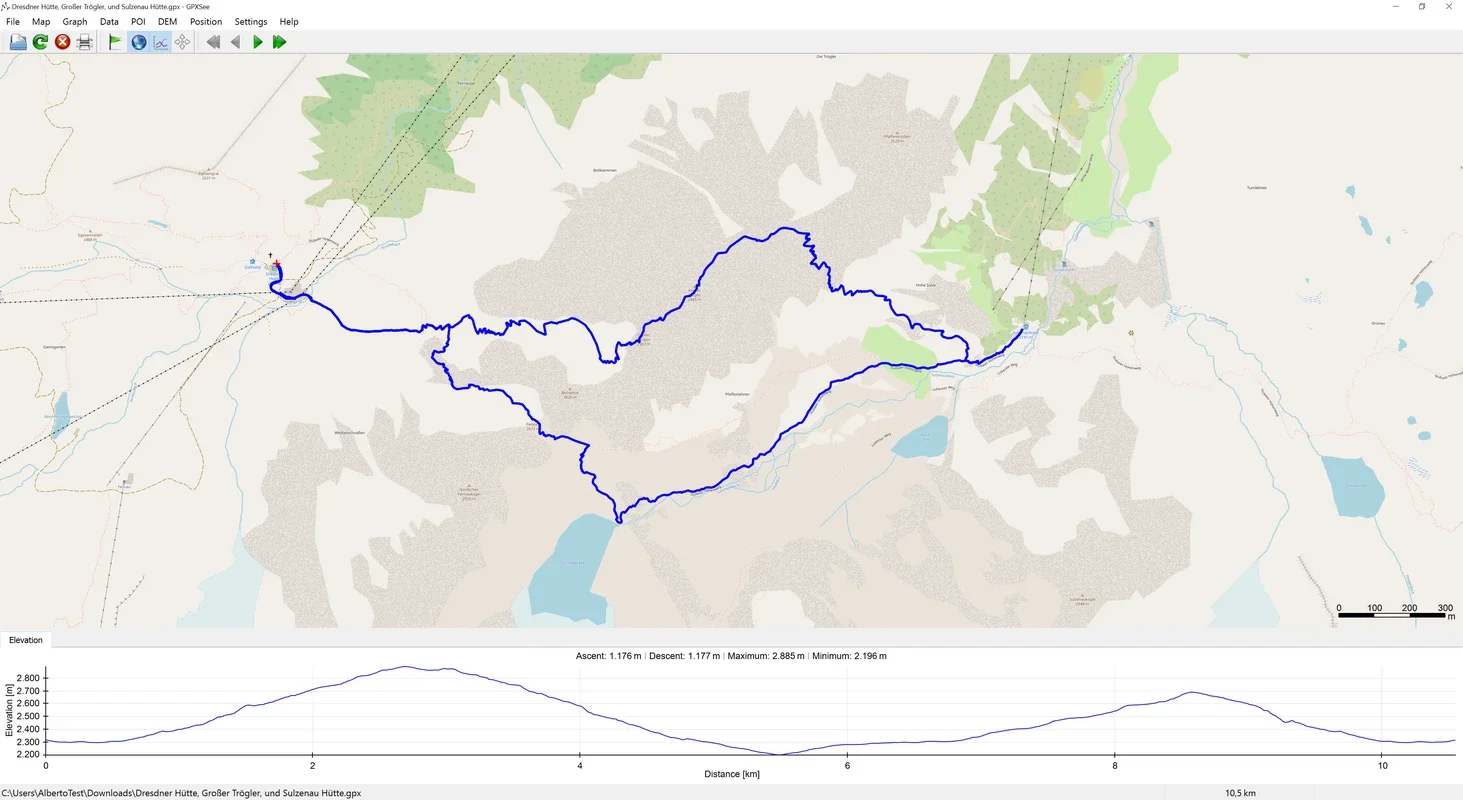
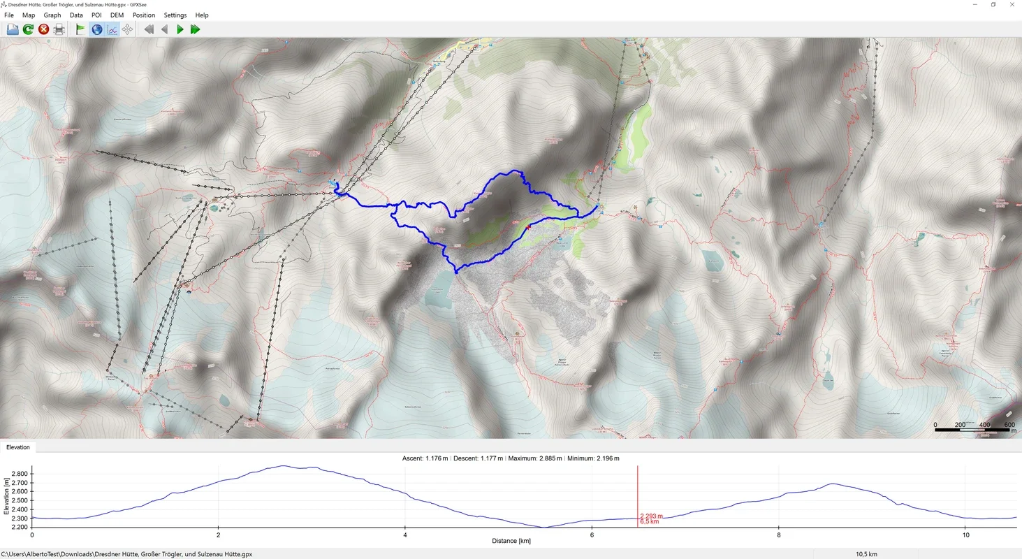
Elevation Analysis
At the bottom of the program, users can view the elevation gain and loss over the duration of the route. By clicking on the elevation zone, they can quickly identify the specific area of the route with the most complex elevation changes.
Conclusion
If you are looking for a program that can accurately visualize routes on your Mac, GPXSee is an excellent choice. With its extensive features and user-friendly interface, it provides a seamless experience for GPS route viewing and analysis. Download GPXSee for Mac today and start exploring your routes in a whole new way.