GPXSee App Introduction
Introduction
GPXSee is a remarkable software that has been designed to meet the needs of those who are interested in viewing and analyzing GPS - recorded routes. It is a powerful tool that offers a wide range of features and capabilities, making it an essential application for outdoor enthusiasts, athletes, and anyone who wants to keep track of their travels.
Supported File Formats
One of the most impressive aspects of GPXSee is its ability to support a large number of file formats. It can handle GPX, TCX, FIT, KML, IGC, CUP, NMEA, SIGMA SLF, Suunto SML, LOC, OziExplorer (PLT, RTE, WPT), GeoJSON, Garmin GPI&CSV, TomTom OV2&ITN, ONmove OMD/GHP, TwoNav (TRK, RTE, WPT) and JPEG files with geolocation. This means that no matter what type of GPS device you are using or what format your data is in, GPXSee can likely handle it.
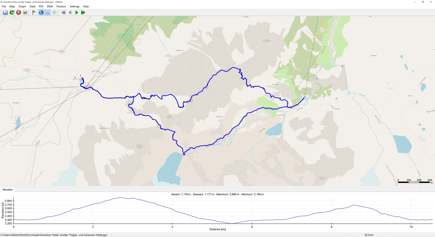
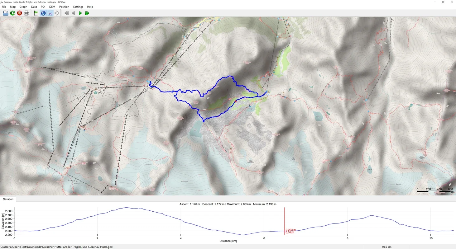
Visualizing GPS Routes
When it comes to visualizing GPS routes, GPXSee does an excellent job. It allows you to place all the GPS locations that you have visited on a map, giving you a clear picture of your journey. But it doesn't stop there. It can also show you other important data such as elevation, pulse, cadence, temperature, and gear changes. This additional information can be extremely useful for athletes who want to analyze their performance or for hikers who want to understand the terrain they have traversed.
Displaying Points of Interest and Multiple Routes
GPXSee also has the ability to display points of interest on your routes. This can be anything from rest stops, scenic viewpoints, or important landmarks. Additionally, it is possible to display several routes at the same time. This is great for comparing different routes or for planning a multi - leg journey.
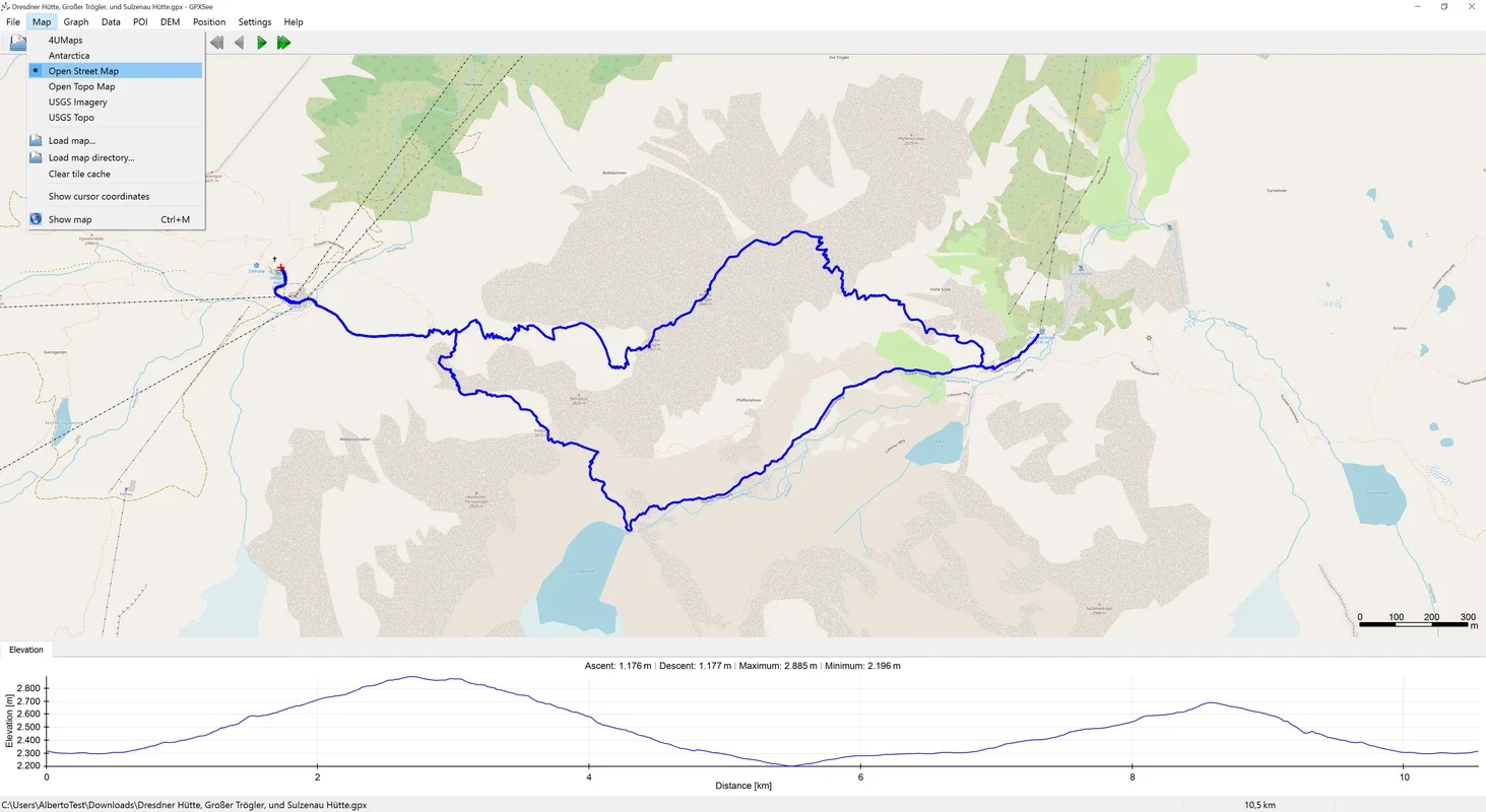
Map Selection
When you open a route in GPXSee, you have the option to choose the type of map you want to use. The program natively supports several popular maps such as OpenStreetMap, which is widely used due to its open - source nature. It also supports 4UMaps, OpenTopoMap, USGS Imagery and USGS Topo. And if you have a different map that you prefer, you can add it to the program, giving you even more flexibility in how you view your routes.
Analyzing Elevation Data
At the bottom of the GPXSee program, you can see the elevation gain and loss over the duration of the route. If you click on the elevation zone, the zone of the route in which that point is located appears. This is an ideal feature for those who want to know the most complicated points of a route, such as steep climbs or descents. It can also be useful for planning future trips, as you can avoid areas that may be too difficult to traverse.
Conclusion
In conclusion, GPXSee is a highly versatile and useful software for viewing and analyzing GPS - recorded routes. Its wide range of supported file formats, ability to display multiple types of data, and flexible map options make it a great choice for anyone who wants to get the most out of their GPS data. Whether you are an athlete looking to improve your performance, a hiker planning your next adventure, or just someone who wants to keep track of your travels, GPXSee has something to offer.