Geotag Photo GPS App Introduction
Introduction
Geotag Photo GPS is a remarkable application that has revolutionized the way we capture and share our photographic memories. In today's digital age, where every moment is worth documenting, this app offers a unique set of features that go beyond just taking pictures.
The Importance of Geotagging in Photography
Geotagging, the process of adding geographical identification metadata to media such as photographs, has become increasingly important. For travelers, it serves as a digital diary of their adventures. They can look back at a photo and instantly recall the exact location where it was taken. For professionals in fields like journalism and research, accurate location data can be crucial for reporting and data collection.
Features of Geotag Photo GPS
Customizable Photo Filters
Geotag Photo GPS comes with a selection of customizable photo filters. These filters not only enhance the aesthetic appeal of the photos but also allow users to add a personal touch to their images. Different filters can be applied depending on the mood or theme of the photo, whether it's a bright and sunny landscape or a moody urban scene.
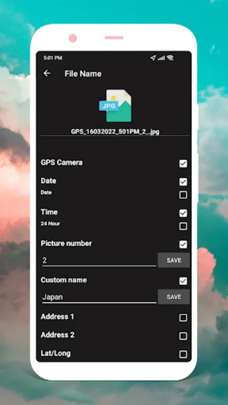
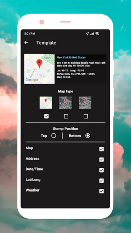
Photo Stamp Templates
In addition to filters, the app offers a variety of photo stamp templates. These templates provide the flexibility to choose how to visually incorporate the metadata into images. Users can select from different styles and layouts to make the geotag information blend seamlessly with the photo or stand out as a unique feature.
Built - in Camera Feature
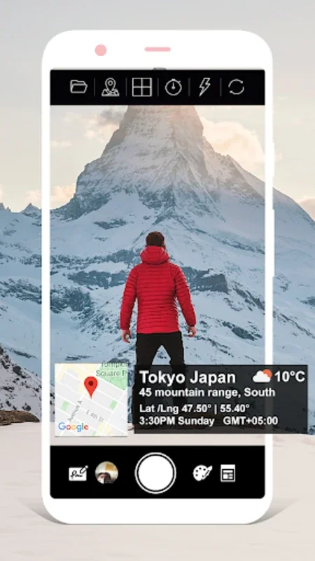
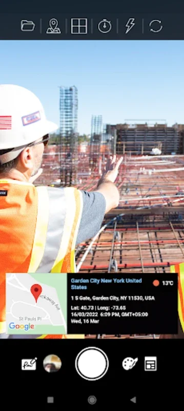
The built - in camera feature is designed with simplicity in mind. It simplifies the process of taking pictures with geolocation data. Users can easily adjust photo ratios, grids, and preferred stamp layouts. The location coordinates can also be personalized, ensuring that the user has full control over how the location data is captured and presented in the photo.
Intuitive User Interface
The app's intuitive and user - friendly interface is one of its major strengths. From the moment users open the app, they are greeted with a seamless experience. Navigating through the various features, such as selecting filters, choosing stamp templates, and adjusting camera settings, is effortless. This ease of use makes it accessible to both novice and experienced photographers.
How Geotag Photo GPS Enhances the Photo Capturing Experience
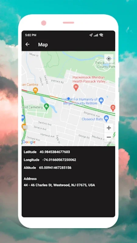
When users take a photo using Geotag Photo GPS, the app automatically embeds time and GPS details. This not only adds context to the photo but also enriches the overall experience. For example, when sharing a photo on social media, followers can see exactly where the photo was taken, which can spark conversations and add more depth to the shared moment.
Comparing Geotag Photo GPS with Other Photo Apps
There are many photo apps available in the market, but Geotag Photo GPS stands out for its focus on geotagging. While some apps may offer basic location tagging, Geotag Photo GPS goes further by providing customizable ways to display the location metadata. It also offers a more comprehensive set of features related to enhancing the photo while still maintaining the integrity of the geotagging process.
Conclusion
In conclusion, Geotag Photo GPS is an essential tool for anyone who values adding context to their photos. Whether it's for personal memories, travel documentation, or professional use, this app offers a seamless and efficient way to capture photos with embedded time and GPS details. By using this app, users can truly embrace the full potential of their photographic memories and share them in a more meaningful way.
Future Developments
As technology continues to evolve, we can expect Geotag Photo GPS to introduce more innovative features. This could include even more advanced customization options for geotags, integration with other social media platforms for seamless sharing, and perhaps even new ways to interact with the location data within the photos.
The Impact on Photography as a Whole
The use of Geotag Photo GPS and similar apps is having a significant impact on photography. It is changing the way we view and share photos, making them more than just visual images but also a source of information. This trend is likely to continue as more and more people recognize the value of adding location and time metadata to their photos.