
Vetus Maps App Introduction
Vetus Maps is a revolutionary application that seamlessly blends historical cartography with modern mapping technology, offering users an unparalleled opportunity to explore the landscapes of the past. Imagine holding a portal to history in your hands, capable of overlaying antique maps onto the familiar terrain of today. This isn't just a map app; it's a time machine for history buffs, scholars, and anyone curious about the evolution of our world.
Unveiling the Past, One Map at a Time
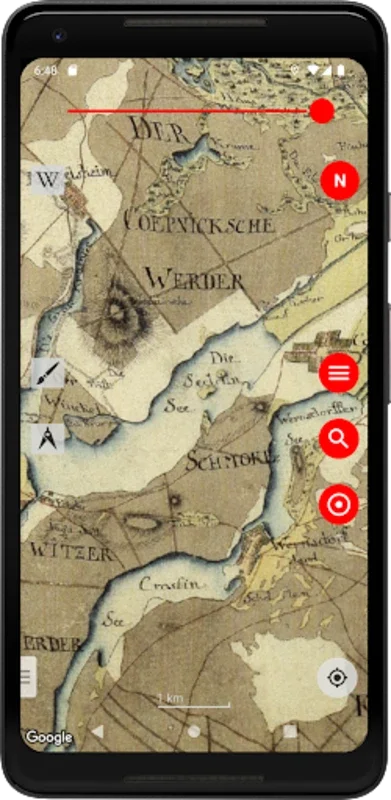
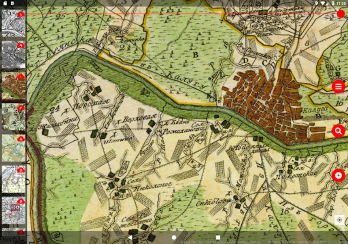
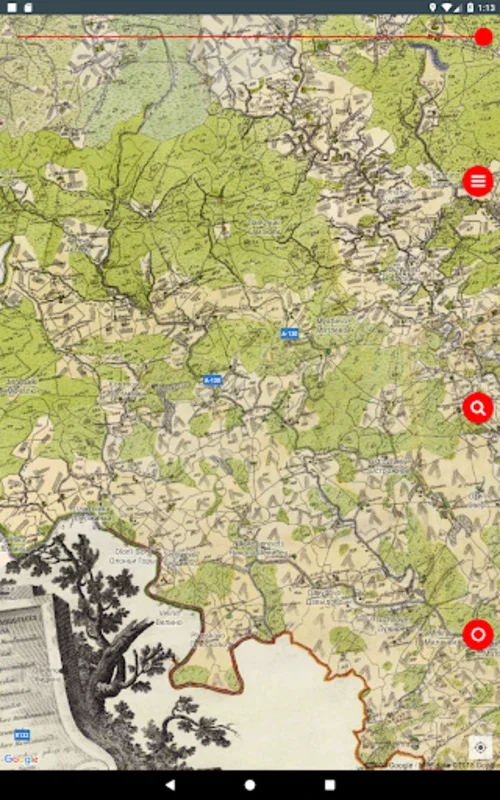
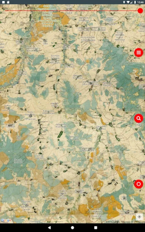
The core functionality of Vetus Maps centers around its ability to superimpose historical maps onto contemporary views. Whether you prefer satellite imagery, a hybrid view, or a detailed terrain map, Vetus Maps allows you to layer historical maps with remarkable precision. This unique feature allows users to witness the geographical transformations that have occurred over centuries, revealing vanished villages, forgotten roads, and the subtle shifts in coastlines and riverbeds.
Imagine tracing the route of a Roman legion across the landscape, or following the path of a medieval trade route as it winds through the countryside. Vetus Maps makes these historical journeys possible, transforming your smartphone into a powerful tool for exploration and discovery.
More Than Just Maps: A Suite of Powerful Features
Vetus Maps is more than just a simple map overlay. It's packed with features designed to enhance your historical explorations:
- Customizable Overlay Transparency: Adjust the transparency of the historical map to achieve the perfect balance between the past and the present. See how the landscape has changed over time, while still maintaining a clear view of modern features.
- Precise Alignment: Ensure the historical map aligns perfectly with the modern view, minimizing distortion and maximizing accuracy.
- Offline Map Access: Download maps for offline use, allowing you to explore historical landscapes even without an internet connection. (Note: Satellite imagery requires an active internet connection.)
- GPS Navigation: Use your device's GPS to navigate the landscape, following the paths charted by historical maps. This feature is particularly useful for exploring historical sites and landmarks.
- Customizable Markers: Place custom markers on the map to highlight points of interest, record your findings, or simply mark your progress during an exploration.
- GPS Track Recording: Record your GPS tracks to document your explorations and create personalized historical journeys.
Unearthing Hidden Histories
Vetus Maps offers a unique opportunity to uncover hidden historical details. Many historical maps contain information that is no longer visible on modern maps. These maps often include details about ancient settlements, forgotten place names, and even archaeological sites. By using Vetus Maps, you can rediscover these lost pieces of history and gain a deeper understanding of the landscapes you explore.
The maps included in Vetus Maps are not just static images; they are windows into the past. They offer a glimpse into the lives of those who lived in these landscapes centuries ago, revealing their settlements, their trade routes, and their connection to the land.
A Comparison to Other Mapping Applications
While other mapping applications offer modern features like satellite imagery and GPS navigation, Vetus Maps stands apart by integrating historical cartography into its core functionality. Unlike applications that focus solely on modern data, Vetus Maps provides a unique perspective on the evolution of our world, allowing users to explore the past and present simultaneously. This integration of historical and modern data is what sets Vetus Maps apart from other mapping applications.
Consider applications like Google Maps or Apple Maps, which primarily focus on current road networks, businesses, and points of interest. While these applications are invaluable for everyday navigation, they lack the historical context provided by Vetus Maps. Vetus Maps offers a complementary experience, enriching the user's understanding of the landscape by adding a layer of historical depth.
The Power of Historical Context
Vetus Maps is more than just a tool; it's a gateway to understanding the past. By combining historical maps with modern technology, Vetus Maps allows users to connect with the history of their surroundings in a tangible and engaging way. Whether you are a seasoned historian or simply curious about the world around you, Vetus Maps offers a unique and enriching experience.
The app's intuitive interface and powerful features make it accessible to users of all levels of expertise. Whether you're exploring your local neighborhood or venturing into uncharted historical territory, Vetus Maps provides the tools you need to uncover the hidden stories embedded within the landscapes we inhabit.
The inclusion of maps from various historical periods and sources, including those from renowned cartographers like Schubert and Mende, and military mappings such as those of the Red Army and GMP, ensures a rich and diverse collection of historical data. This breadth of sources allows users to explore a wide range of historical perspectives and gain a deeper understanding of the evolution of cartography itself.
Conclusion: Your Journey Through Time Begins Now
Vetus Maps is an invaluable resource for anyone interested in history, geography, or simply exploring the world around them in a new and engaging way. Its unique blend of historical data and modern technology makes it a powerful tool for both casual exploration and serious historical research. Download Vetus Maps today and begin your journey through time!