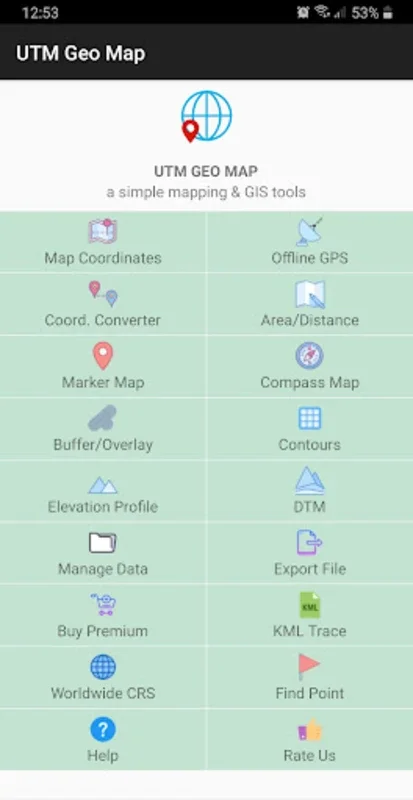
UTM Geo Map App Introduction
Introduction to UTM Geo Map
UTM Geo Map is a remarkable application that caters to the needs of professionals in various fields such as Land Surveying, Topography, Bathymetry, Geodesy Engineering, Civil Engineering, and Geology. It serves as an indispensable asset for those who require advanced mapping and spatial analysis capabilities.
Key Features of UTM Geo Map
Position Determination and Spatial Analysis
The application allows for the precise determination of positions. It also enables users to measure areas and distances accurately. Moreover, it has the capacity to perform complex spatial analyses like Overlay and Buffering. This makes it a powerful tool for professionals who need to analyze spatial relationships between different geographical features.
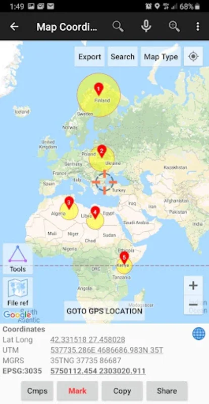
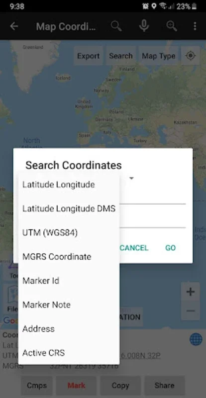
Map Coordinates Feature
The 'Map Coordinates' feature is highly intuitive. It provides users with the ability to obtain the most current data in multiple coordinate systems, including Latitude Longitude and UTM. Along with the basic coordinate information, it also offers additional details such as time, elevation, and notes. This comprehensive set of information can be extremely valuable for field professionals who need to record and analyze geographical data in different contexts.
Offline GPS Capability
One of the standout features of UTM Geo Map is its 'Offline GPS' functionality. This ensures that data collection can occur even without an internet connection. Essentially, it transforms a mobile device into a fully - functional GPS unit. Users can store an unlimited number of data points and export them in various formats for further in - depth examination. This is especially useful for professionals working in remote areas where internet connectivity may be limited or non - existent.
Coord. Converter
The 'Coord. Converter' is another useful feature. It allows for manual conversions between Latitude Longitude and UTM. Additionally, when online, it can be used for geocoding addresses. This simplifies the process of working with different coordinate systems and address - related geographical data.
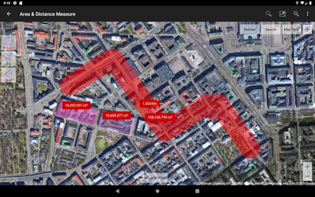
Area/Distance Module
For the measurement and cataloging of spatial features, the 'Area/Distance' module is equipped with a variety of tools. These tools are designed for editing and exporting spatial data. This enables users to accurately measure and manage the spatial aspects of geographical features, which is crucial for tasks such as land surveying and civil engineering projects.
Marker Map and Compass Map
The 'Marker Map' builds on the basic functions by offering dynamic geometry computations and analysis. This can be used for more in - depth study of geographical features and their relationships. The 'Compass Map', on the other hand, aids in navigation through an integrated compass. This is particularly helpful for professionals who need to navigate through different terrains while collecting data or conducting surveys.
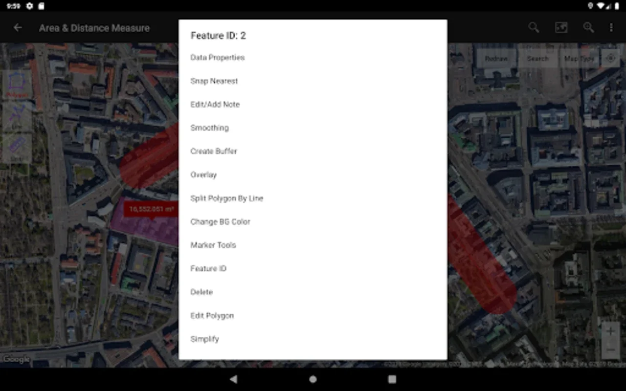
Advanced Modules
UTM Geo Map also includes advanced modules such as 'Buffer/Overlay' for GIS operations, 'Elevation Profile' for cross - sectional terrain representation, and 'Contours' for contour line mapping. While some of these modules may require premium access, they significantly enhance the overall functionality of the application for more advanced mapping and analysis tasks.
Digital Terrain Model (DTM) Module
The 'Digital Terrain Model (DTM)' module is yet another feature that adds to the versatility of UTM Geo Map. It is used for TIN/GRID surface generation and Cut and Fill volume calculations. This makes the application suitable for a wide range of mapping and spatial analysis tasks, especially those related to terrain analysis and engineering projects.
Utility and Limitations
While some of the application's functionalities require a premium subscription or an internet connection, its offline utility cannot be overlooked. The ability to perform a significant amount of work offline is a major advantage for field professionals. However, users should be aware of the limitations regarding premium features and internet - dependent functions.
Conclusion
UTM Geo Map is a comprehensive and versatile application that offers a wide range of features for mapping and spatial analysis. It has the potential to greatly assist professionals in multiple fields, from engineering to geology. Despite some limitations, its offline capabilities and extensive feature set make it a valuable tool for those in need of advanced geographical data analysis.