TrekMe - GPS trekking offline App Introduction
Introduction
TrekMe - GPS Trekking Offline is a remarkable software designed specifically for outdoor enthusiasts. Whether you are an avid trekker, a passionate cyclist, or someone who simply loves to explore the wilderness, this app has a great deal to offer. It provides a seamless experience even without an active internet connection, which is a huge advantage when you are out in the wild.
Offline Functionality
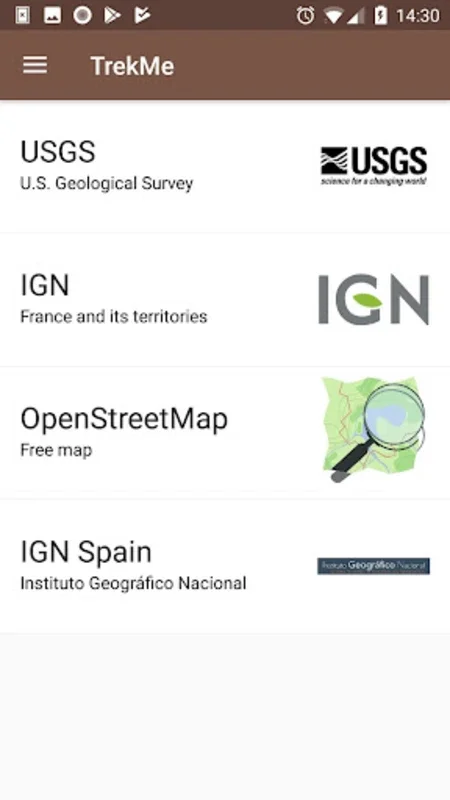
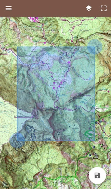
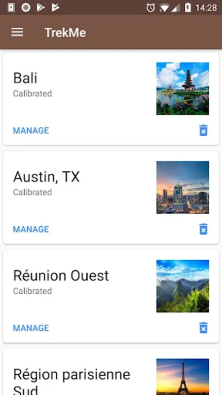
One of the most appealing aspects of TrekMe is its offline functionality. You can access maps and determine your real - time location without relying on the internet. However, it should be noted that an initial map area download does require an internet connection. This is a small price to pay for the freedom it offers once you are out in the field. With a variety of map sources such as USGS, OpenStreetMap, SwissTopo, and IGN (for France and Spain), you have extensive coverage for different types of expeditions. The regular addition of new topographic maps also ensures that you have the most up - to - date information at your fingertips.
User - Friendly Experience
The app is designed with the user in mind. It offers a smooth experience that is not only easy to navigate but also conserves battery life. This is crucial for long - duration outdoor activities. Additionally, its compatibility with SD cards allows for efficient storage of even the largest and most detailed maps. You don't have to worry about running out of space on your device when you have TrekMe installed.
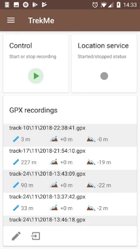
Essential Features
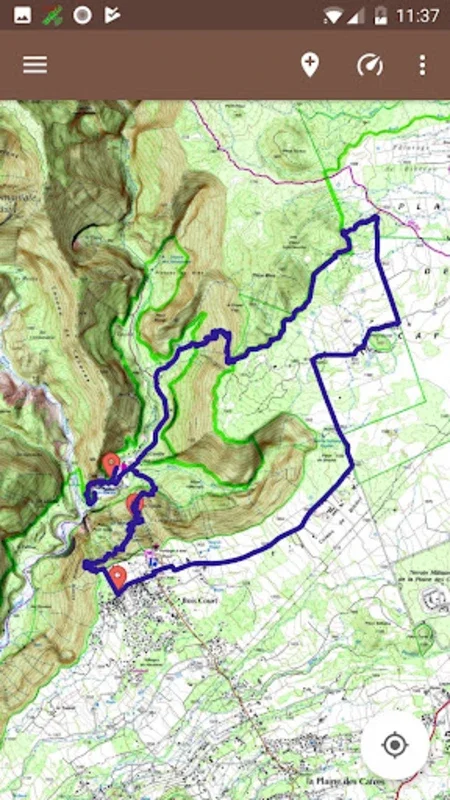
TrekMe comes loaded with a host of features that are beneficial for both experienced adventurers and casual outdoor lovers. It allows for the import, recording, and sharing of GPX files. You can customize markers, get real - time statistics on your GPX track, and monitor important metrics like orientation, distance, and speed. The ability to measure distances on your track and set alerts to stay on your intended route is also a great addition. For those who need more accurate and faster position updates, the Bluetooth connectivity with external GPS devices is a very useful feature, especially for professional topographic work or when high precision is required.
Privacy Considerations
Privacy is a key concern for many users, and TrekMe addresses this well. While it does collect location data during GPX recordings, this data is stored securely on your device and is not shared externally. However, it is important to be aware that some map providers may require a subscription, such as for accessing IGN maps in France.
Conclusion
In conclusion, TrekMe - GPS Trekking Offline is an invaluable tool for anyone who enjoys outdoor activities. It gives you the confidence to explore nature without the fear of getting lost or running out of battery. With its combination of useful features, offline capabilities, and user - friendly design, it is a must - have for outdoor enthusiasts.
TrekMe vs. Other Outdoor GPS Apps
When comparing TrekMe to other outdoor GPS apps, it stands out in several ways. For example, its offline functionality is more robust compared to some apps that rely heavily on internet connectivity. The variety of map sources it offers also gives it an edge, as it can provide more comprehensive coverage for different regions. Additionally, its focus on privacy and security of user data is a significant advantage.
How to Get the Most Out of TrekMe
To make the best use of TrekMe, it is important to familiarize yourself with all of its features. Spend some time exploring the different map sources and understanding how to import and share GPX files. Also, take advantage of the customization options for markers and alerts. By doing so, you can enhance your outdoor experience and ensure that you are well - equipped for any adventure.
TrekMe's Impact on Outdoor Exploration
TrekMe has had a positive impact on outdoor exploration. It has made it easier for people to venture into less - known areas with confidence. The ability to access detailed maps offline and track important metrics has empowered adventurers to plan and execute their trips more effectively. It has also contributed to the safety of outdoor enthusiasts by providing features like distance alerts and accurate location tracking.