nv charts App Introduction
Introduction
The nv charts app is an indispensable tool for marine navigation. Designed specifically to enhance your experience on the water, whether you're cruising, fishing, sailing, or diving, it offers an intuitive user interface and state-of-the-art features.
Offline Navigation Capabilities
One of the key features of nv charts is its offline navigation capabilities. You can easily download up-to-date boating charts across various regions, including the North Sea, Baltic Sea, and the Caribbean. This allows you to navigate without an internet connection, ensuring that you never lose your way.
Combined Paper and Digital Chart Formats
nv charts offers the premium feature of combining paper and digital chart formats. This allows you to have the best of both worlds, with the convenience of digital charts and the familiarity of paper charts. Additionally, the app comes with an updating service to keep both mediums current, ensuring that you always have the most accurate information.
Digital Chart Subscriptions
For users seeking flexibility, digital chart subscriptions are available within the application. These subscriptions come with an auto-renewal feature, ensuring that you always have uninterrupted service. Even without a subscription or current paper chart edition, free online charts are accessible for preliminary journey planning.
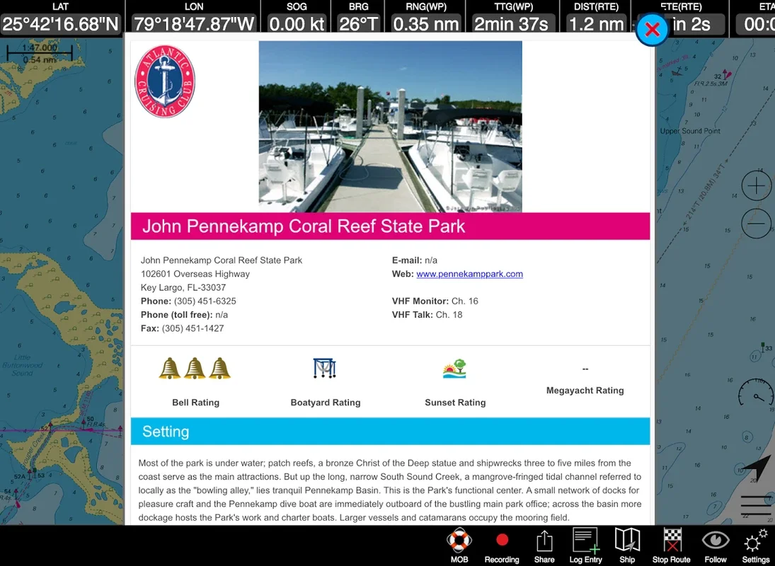
Safety and Community Contributions
Safety is at the heart of nv charts. You'll have access to the Seame boating community, where you can add and share points of interest, such as marinas and restaurants, complete with images and comments. This allows you to stay ahead with updated nautical information and utilize the enhanced search function to find essential services or features nearby.
Auto-Routing
Auto-routing is another great feature of nv charts. It simplifies reaching your chosen destination by providing you with the most efficient route. This saves you time and effort, allowing you to focus on enjoying your time on the water.
Collaborative Features
nv charts also offers collaborative features, making it easy to share your journey with friends. You can export tracks as GPX files and effortlessly share favorite spots using simple links, facilitating trip coordination.
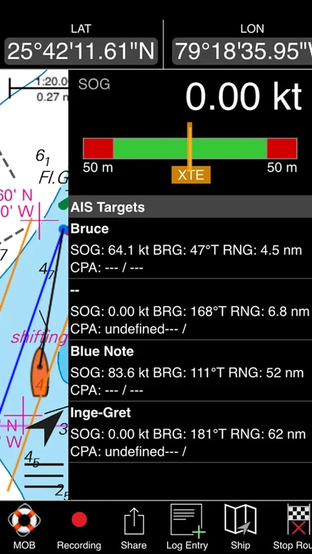
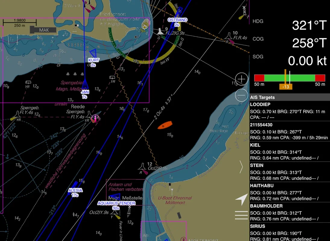
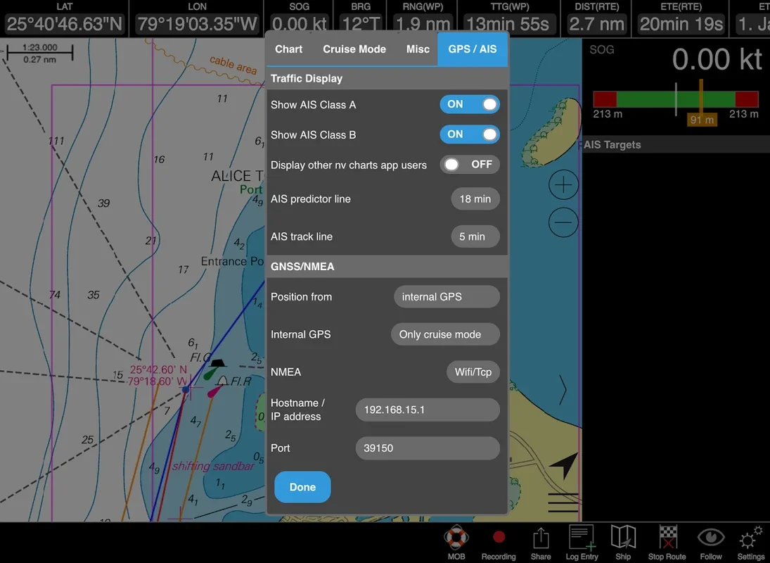
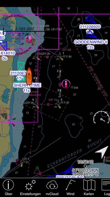
Real-Time AIS Signal Monitoring
Real-time AIS signal monitoring is made possible by connecting to a WLAN AIS receiver. This allows you to assess maritime traffic situations and improve safety on the waters. With this feature, you can stay informed about other vessels in the area and avoid potential collisions.
Synchronization Across Devices
With synchronization capabilities across multiple devices, nv charts ensures that navigation is a convenient and shared experience. Whether you're using your phone, tablet, or other device, you can access your navigation data and share it with others.
Hardware Compatibility
For Android users, the software requires version 7.0 or higher. It's important to note that continued GPS usage in the background may significantly impact battery life. For hardware compatibility queries, consult the FAQs on the nv charts website.
In conclusion, nv charts is a must-have app for anyone who loves marine navigation. With its offline navigation capabilities, combined paper and digital chart formats, digital chart subscriptions, safety features, collaborative tools, and real-time AIS signal monitoring, it offers a comprehensive solution for all your marine navigation needs.