
MyTrails App Introduction
Introduction
MyTrails is an application designed to enhance the outdoor experience for enthusiasts who enjoy various activities like hiking, biking, running, skiing, and orienteering. It provides a seamless, ad-free experience even in its free version, ensuring users have uninterrupted access to its features.
Premium Topographical Maps
The standout feature of MyTrails is the premium topographical maps. Users can access these high-quality maps through in-app purchases. These maps are perfect for outdoor activities and include specialized options like marine maps for coastal adventures. With these maps, users can explore the great outdoors with confidence.
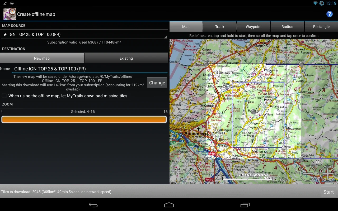
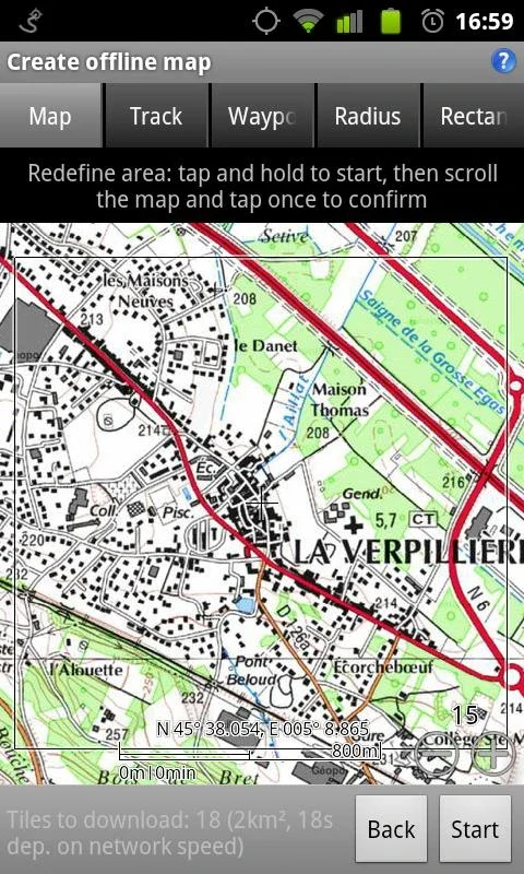
Offline Mode
The application provides a flexible offline mode, allowing users to save maps locally. This not only conserves battery life but also reduces data usage. Users can access their favorite maps even when they are offline, making it an ideal tool for outdoor adventures.
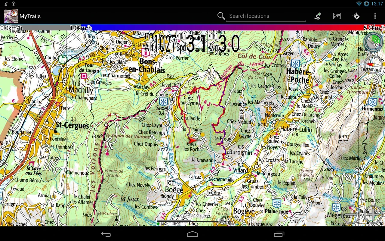
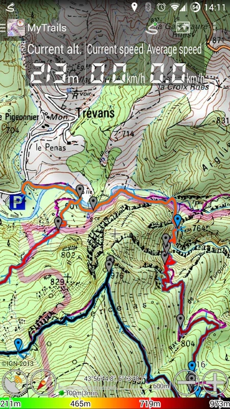
Full-Screen Trail Map
With MyTrails, users experience a full-screen trail map that automatically orients according to their direction of travel using the phone's built-in compass and GPS. The clarity of the display is unmatched, even when rendering numerous track points. This makes it easy for users to navigate through the outdoors.
Statistics and Dashboard
The app offers a selection of over 40 statistics to monitor and display on a dashboard, overlaying the map, or on an Android Wear device. Users can track and visualize their performance with detailed graphs and elevation profiles, gaining valuable insights into their activities.
Recording and Sharing
This application allows users to record their GPS tracks conveniently. Pro users can display multiple colorized tracks simultaneously to compare past outings. Additionally, the Pro version enables sharing on platforms like My Trails and downloading tracks shared by others, making it easy to share and archive routes.
Tablet Support and Sync
Designed to offer full tablet support, the software allows sync capabilities through Dropbox. This makes it easy for users to transition between devices and plan their outdoor ventures on a larger screen. With all the necessary details at their fingertips, users can enjoy their activities to the fullest.
Conclusion
In summary, MyTrails remains a comprehensive navigation tool tailored to the needs of outdoor enthusiasts. Its combination of detailed maps, offline functionality, and rich statistical analysis makes it an indispensable addition to any adventurer's toolkit. With MyTrails, users can explore the great outdoors with ease and confidence.