Land id App Introduction
Land id is a game-changer in the realm of real estate exploration and analysis. With its advanced mapping technology, it provides users with a comprehensive set of tools to access detailed property information effortlessly.
Enhanced Mapping Features for Professionals
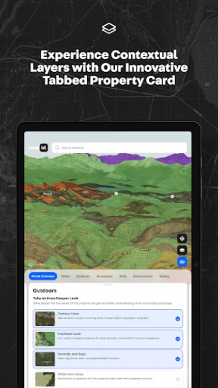
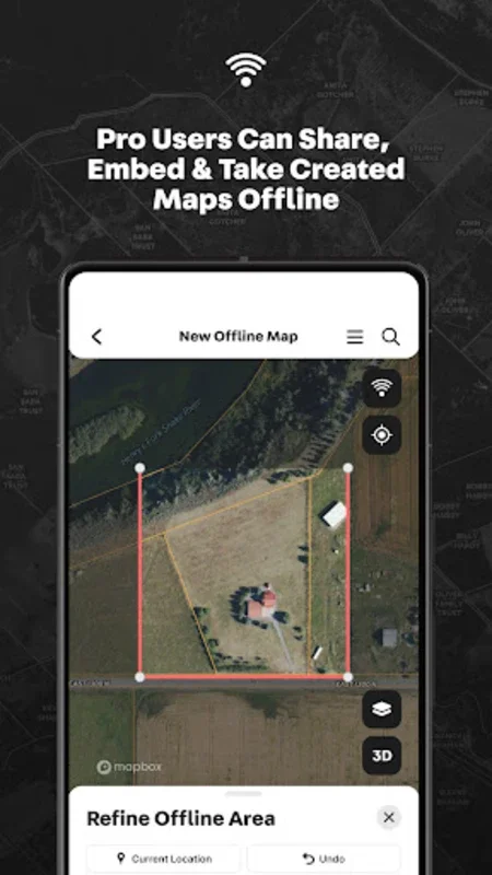
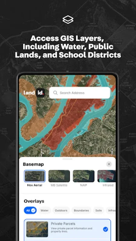
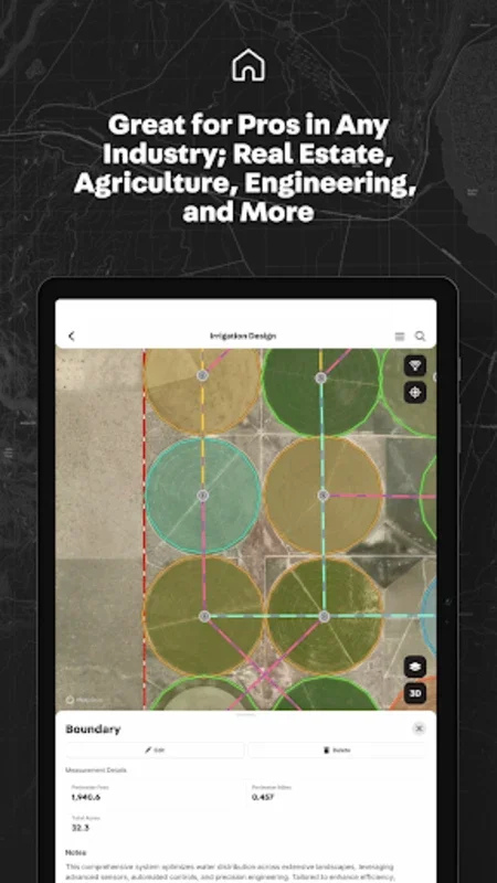
Land id empowers users with intuitive tools to create interactive property maps. It enables precise overlays for water features, soil types, FEMA floodplains, and other data layers, enhancing the ability to make informed decisions. The integration of GPS tracking and offline accessibility ensures seamless navigation in the field without interruptions. Users can add waypoints, measure distances like roads or fences, and embed property-specific images or videos, tailoring presentations to their projects. The versatile platform eliminates the need for multiple tools, offering all essential mapping functions in one place.
Tailored Plans for Varied Needs
Flexible subscription plans are available for monthly or annual billing, catering to diverse user needs. Advanced options like Land id Pro and Pro Unlimited go further with features such as deed plotting for near-survey-grade accuracy, multi-user support, and centralized billing. These plans are ideal for real estate professionals seeking detailed mapping solutions for impactful presentations and property management.
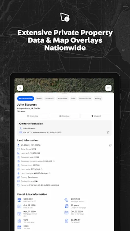
Land id combines innovation and convenience, offering a robust platform for exploring and managing properties efficiently. It allows users to view properties in 2D or 3D, study high-resolution satellite images, and utilize topographic base maps to bring locations to life. Critical details such as ownership, acreage, tax values, and previous sales history are easily accessible with a single tap, streamlining property evaluation.
In conclusion, Land id is a must-have tool for real estate professionals, investors, and individuals conducting property research. It redefines the way we explore and analyze real estate, providing valuable insights and saving time and effort.