GPS Air Navigator App Introduction
GPS Air Navigator is a revolutionary tool designed specifically for Visual Flight Rules (VFR) air navigation on the Android platform. This comprehensive article will explore the numerous features and benefits that make GPS Air Navigator a must-have for pilots worldwide.
Introduction
GPS Air Navigator is not just an ordinary navigation app; it is a sophisticated tool that provides pilots with real-time GPS functionality and a plethora of essential navigational features. With its user-friendly interface and advanced capabilities, it has become the go-to choice for many aviators.
Key Features
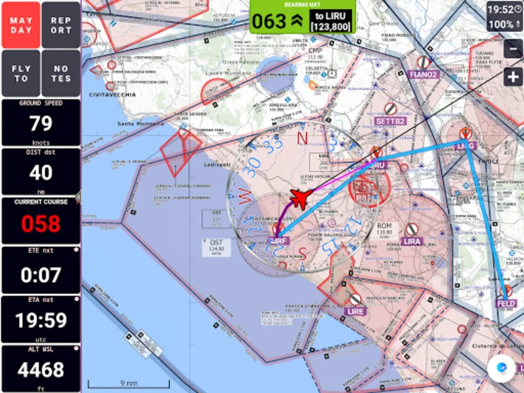
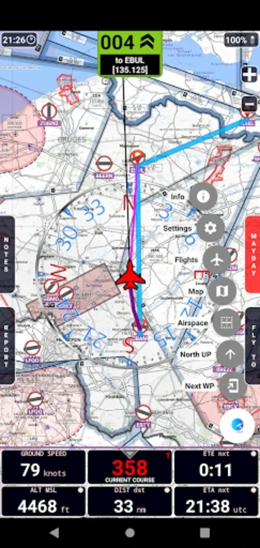
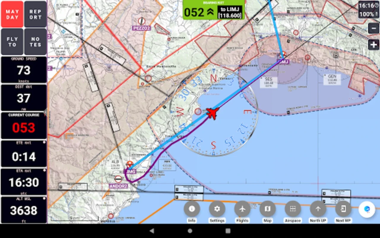
- Real-Time Moving Map: The app offers a real-time moving map that provides a graphical display of country airspace. Pilots can navigate using either True or Magnetic North orientations, ensuring accurate and reliable navigation.
- High-Quality VFR Aeronautical Charts: GPS Air Navigator provides high-quality VFR Aeronautical Charts for selected regions, including Portugal, Spain, and various South American and European countries. For pilots flying in the USA, Sectional VFR Charts sourced from the FAA are available, while Brazilian aviators can utilize WAC and REA Charts supplied by DECEA-Brazil.
- Integration of Maps: The software integrates free OpenStreetMap maps for global coverage and specialized OpenFlightMaps for numerous European countries. This ensures that pilots have access to detailed and up-to-date maps wherever they fly.
- Daily Airspace Information Updates: Operators over Portugal will appreciate the inclusion of daily airspace information updates through the FuaFlex service integration. This feature keeps pilots informed of the latest airspace changes, enhancing safety and efficiency.
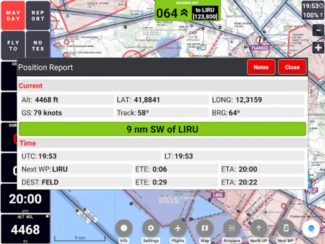
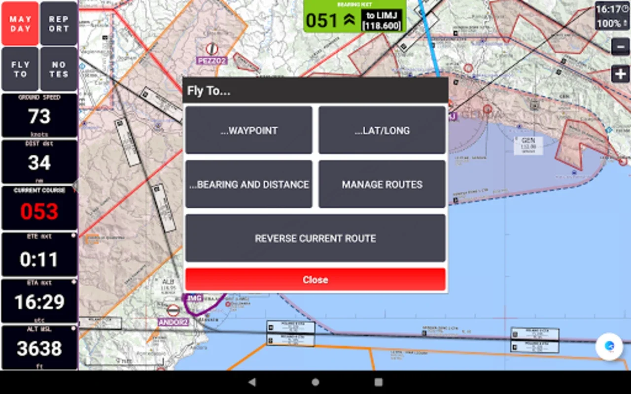
- Comprehensive Database: The app contains a comprehensive database of over 56,000 waypoints. Pilots can also create and manage personal waypoints and routes, allowing for customized navigation.
- Enhanced Safety Features: The MAYDAY feature sends an automatic SMS with the current location and prompts a route to the nearest waypoint (compatible devices only). This feature provides an added layer of safety in case of an emergency.
- Flight Tracking and Analysis: Users can record real-time flight tracks, save them for offline analysis, and share their flight stats across social platforms or via email. This feature allows pilots to review their flights and make improvements for future flights.
- Multi-Device Compatibility: Navigating across multiple Android devices is streamlined with GPS Air Navigator. With just a single license purchase, pilots can use the app on multiple devices, making it convenient for those who fly with multiple devices.
How to Use GPS Air Navigator
Using GPS Air Navigator is straightforward. After downloading the app, pilots can start by familiarizing themselves with the interface. The real-time moving map is the centerpiece of the app, and pilots can easily navigate through the map using the touchscreen controls. The app also provides clear instructions on how to use the various features, such as creating and managing waypoints and routes. Pilots can also customize the settings to suit their preferences, such as choosing the display mode and map types.
Who is GPS Air Navigator Suitable For
GPS Air Navigator is ideal for both novice and experienced pilots. Whether you are a recreational pilot or a professional aviator, this app offers features that can enhance your navigation experience. It is particularly useful for pilots who fly in areas with complex airspace or those who require accurate and up-to-date navigational information.
Conclusion
In conclusion, GPS Air Navigator is a game-changer in the world of VFR air navigation. Its advanced features, global coverage, and user-friendly interface make it the ultimate navigation app for Android. With GPS Air Navigator, pilots can fly with confidence, knowing that they have a reliable and comprehensive navigation tool at their fingertips. So, if you are a pilot looking for a top-notch navigation app, look no further than GPS Air Navigator.