Earth 3D Map App Introduction
Introduction to Earth 3D Map
Earth 3D Map is an innovative software that provides users with a remarkable virtual exploration experience. It allows individuals to traverse the globe from the comfort of their own devices, offering a wealth of features that make it a valuable tool for various purposes.
Features of Earth 3D Map
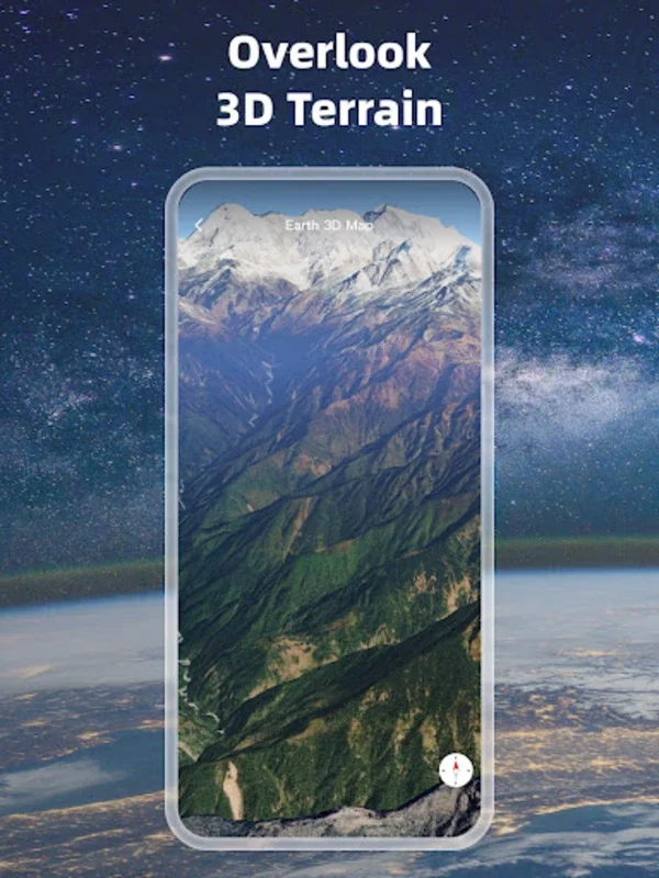
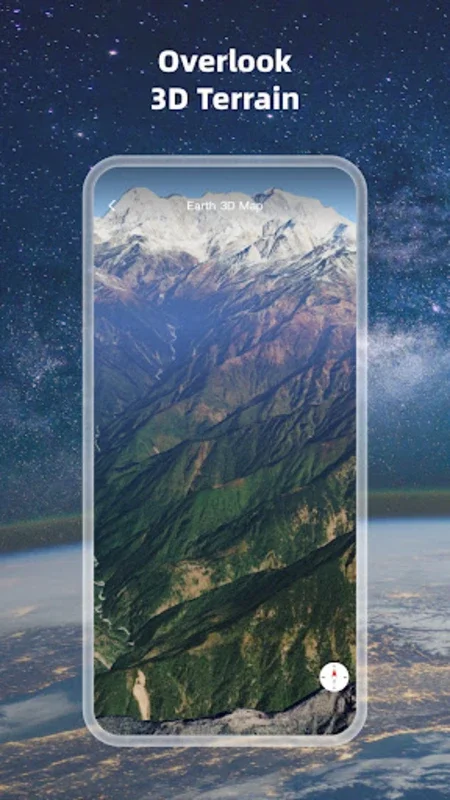
High - Definition 3D Globe
The high - definition 3D globe is the centerpiece of this software. It presents a vivid and immersive representation of the Earth. With detailed terrain, forests, water bodies, urban areas, and roadways clearly depicted, users can gain a deep understanding of the planet's physical features. The high - resolution imagery ensures that even the smallest details are visible, making it an excellent resource for those interested in geography or environmental science.
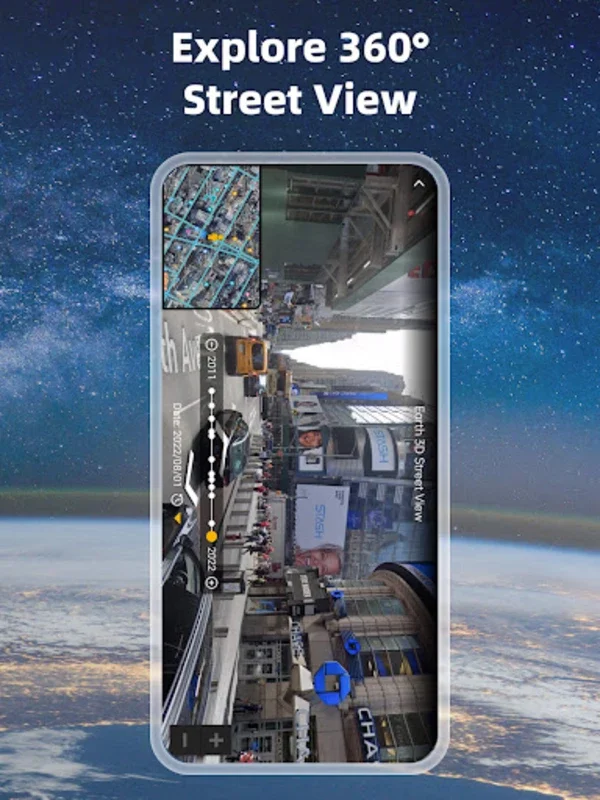
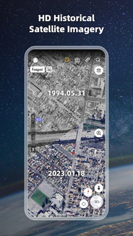
Historical Street Views
One of the most fascinating aspects of Earth 3D Map is its historical street views. This feature enables users to travel back in time and see how different locations have changed over the years. It can be a great educational tool, as it allows students to study the evolution of cities and landscapes. For example, one can compare the layout of a city in the past with its current state, observing how urban development has occurred.
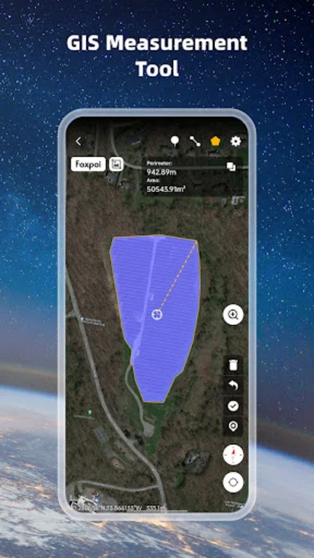
Oriental Compass and Measurement Tools
The software also includes an oriental compass, which aids in navigation. This is especially useful for those who are exploring different parts of the world virtually. Additionally, accurate distance and area measurement tools are available. Whether you are planning a trip and need to estimate distances between locations or are conducting research on the size of different geographical areas, these tools come in handy.
Earth 3D Map for Different Users
Educational Use
In the educational realm, Earth 3D Map is a powerful resource. Teachers can use it to enhance geography lessons, making the subject more engaging and interactive. Students can explore different countries, study their topographies, and learn about the cultures associated with each region. For instance, they can examine the relationship between the terrain and the way of life in a particular area. It can also be used in environmental science classes to study ecosystems and the impact of human activities on the environment.
Travel Planning
For travelers, Earth 3D Map is an invaluable tool. It allows them to preview their destinations before embarking on a journey. They can familiarize themselves with the layout of a city, identify key attractions, and plan their routes more effectively. This can save time and make the travel experience more enjoyable. For example, a traveler can use the software to find the best way to get from the airport to their hotel, taking into account traffic patterns and local landmarks.
Casual Exploration
Even for those who are simply curious about the world, Earth 3D Map offers hours of entertainment. Users can randomly explore different parts of the globe, discover hidden gems, and learn interesting facts about various locations. It can be a great way to pass the time while also expanding one's knowledge of the world.
The Significance of Earth 3D Map
Earth 3D Map is not just a software; it is a gateway to a better understanding of our planet. It breaks down geographical barriers and allows users to experience different parts of the world without leaving their homes. By providing a comprehensive view of the Earth's topography and infrastructure, it encourages users to think globally and appreciate the diversity of our planet.
In conclusion, Earth 3D Map is a versatile and engaging software that has something to offer for everyone. Whether you are a student, a traveler, or just someone with a thirst for knowledge, this software can enhance your understanding of the world around us.