DeepStateMap App Introduction
Introduction
DeepStateMap is a remarkable software that has emerged as a crucial resource for those interested in the military operations within the Ukraine conflict. It offers a detailed and up - to - date view of the situation on the ground, without the need for users to rely on multiple, disparate sources of information.
The Map's Features
Territorial Representation
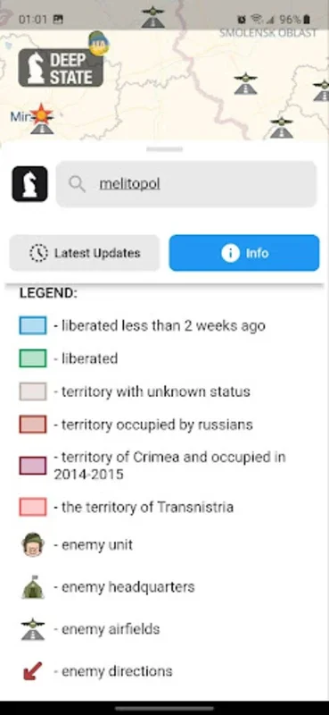
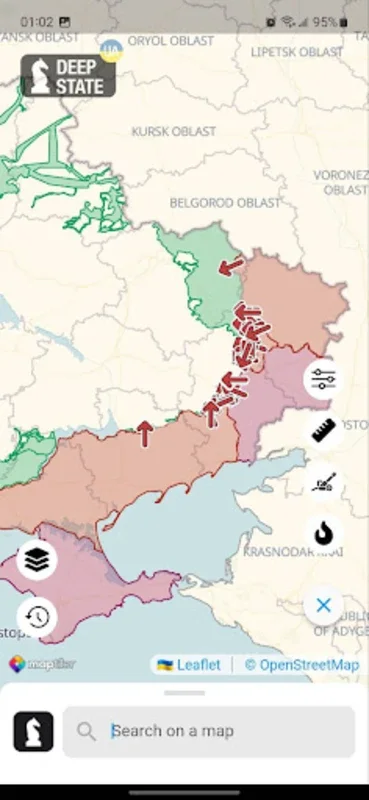
The map is designed with great attention to detail when it comes to representing the territories involved in the conflict. It uses distinct symbols to mark different statuses of the areas. For example, areas that have been recently liberated are clearly marked, as are regions that require further verification. The occupied zones, such as Crimea and ORDLO, along with Transnistria, are also clearly identifiable. This allows users to quickly get a sense of the territorial situation at a glance.
Military Unit Tracking
One of the most significant aspects of DeepStateMap is its ability to track Russian military units. It can show the locations of units, headquarters, airfields, fleet positions, and the axes of assaults. This information is invaluable for those who are trying to understand the strategic movements and intentions of the Russian military within the context of the conflict.
Caching for Offline Use
In a world where internet connectivity can be unreliable, especially in conflict - affected areas, the caching feature of DeepStateMap is a game - changer. Users can cache data for offline review, ensuring that they can stay informed even when they are not connected to the internet. This means that individuals who are on the move or in areas with limited connectivity can still access the important information provided by the map.
User Interface and Additional Tools
Intuitive Interface
The user interface of DeepStateMap is intuitive and user - friendly. The territories are divided into zones that are clearly colored, making it easy for users to identify different areas. This simple yet effective design choice ensures that users can quickly navigate the map and find the information they are looking for without having to spend a lot of time learning how to use the software.
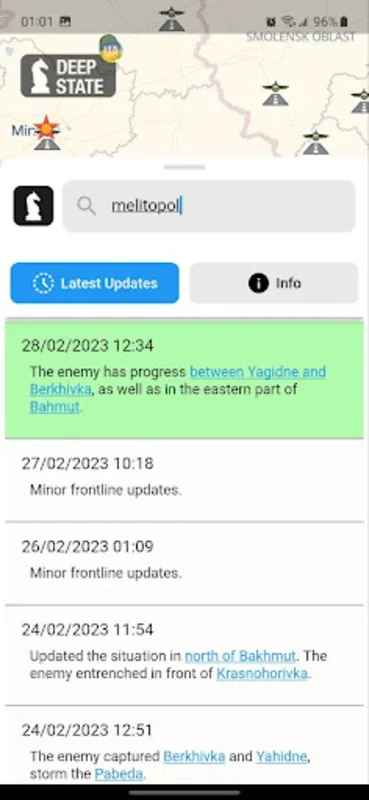
Live News Feed
To enhance the situational awareness of its users, DeepStateMap includes a live news feed. This feed provides the latest updates on the conflict, allowing users to stay informed about the most recent developments. By integrating the news feed with the map, the software provides a more comprehensive view of the situation, combining both geographical and news - based information.
Distance Measurement Tool
Another useful tool included in the software is the distance measurement tool. This allows users to make tactical assessments by measuring the distance between various geographic points on the map. Whether it is for estimating the range between military units or for understanding the proximity of different areas, this tool adds another layer of functionality to the software.
Artillery Analysis and Fire Points
Artillery Range Analysis
DeepStateMap has an innovative mode that enables users to analyze artillery ranges. It can show the ranges of systems such as HIMARS, M777, and CAESAR across the entire frontline. This is a valuable feature for military strategists and analysts, as it allows them to better understand the potential impact of artillery in different areas of the conflict.
Fire Points Display
The fire points display, which is sourced from NASA's Firms system, is another important aspect of the software. It provides a visual representation of fire points, which can be compared against the ongoing front lines. This gives users a better understanding of the areas that are most affected by artillery fire and can help in predicting future military movements.
Conclusion
In conclusion, DeepStateMap is a vital tool for anyone who needs to stay informed about the ongoing conflict in Ukraine. Its comprehensive features, including territorial representation, military unit tracking, caching for offline use, an intuitive user interface, a live news feed, distance measurement tools, artillery range analysis, and fire points display, make it a must - have for those interested in the military operations in the region. Whether it is for military strategists, journalists, or simply individuals who want to stay updated on the situation, DeepStateMap provides a reliable and detailed source of information.