Coordinate Plot App Introduction
Coordinate Plot is a game-changer in the world of mobile survey planning. This Android application is designed to meet the needs of professionals in the field, offering a seamless and efficient experience.
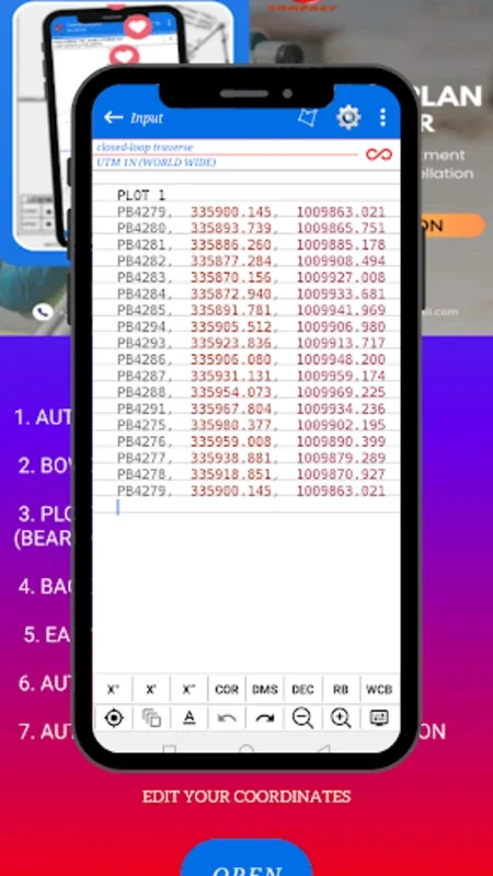
How to Use Coordinate Plot
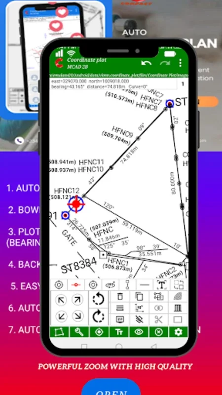
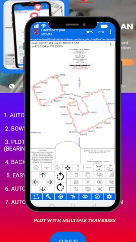
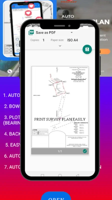
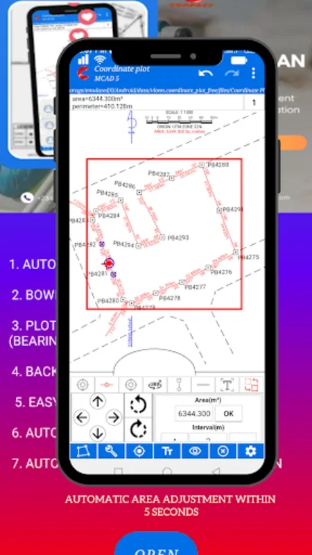
The software provides a user-friendly interface that makes it easy for users to get started. Users can begin by inputting their survey data, including coordinates, bearings, and distances. The editing tools are intuitive, allowing for precise adjustments. The plotting features are a standout, enabling users to visualize their survey plans with clarity.
Who is Suitable for Using Coordinate Plot
This app is ideal for professionals in various fields such as civil engineering, architecture, and land surveying. It is also useful for individuals who need to plan and execute surveys for personal projects or research.
The Key Features of Coordinate Plot
- Comprehensive Editing Tools: Coordinate Plot offers a suite of tools for editing coordinates, bearings, and distances, ensuring accuracy in survey planning.
- Intuitive Plotting Features: The application's plotting capabilities allow users to create clear and detailed visual representations of their survey plans.
- Customizable Themes and Scaling Options: Users can customize the appearance of their survey plans with customizable themes and easy-to-adjust scaling options.
- Define Plan Titles and Origins: This feature adds a level of organization and clarity to the survey planning process.
- Specialized Road Design Tools: The incorporation of specialized road design tools enhances the precision of survey implementations, particularly in projects related to infrastructure development.
The Advantages of Using Coordinate Plot
- Increased Productivity: By streamlining the survey planning process, Coordinate Plot helps users save time and increase productivity.
- Precision and Accuracy: The advanced features of the software ensure that survey plans are precise and accurate, reducing the potential for errors.
- Portability: As a mobile application, Coordinate Plot allows users to work on their survey plans anywhere, anytime, providing greater flexibility and convenience.
In conclusion, Coordinate Plot is a powerful tool that combines advanced functionality with simplicity. It is a must-have for professionals and individuals who require efficient and accurate mobile survey planning. Explore the capabilities of this platform and discover how it can transform the way you approach your work.
Conclusion
Coordinate Plot is not just an app; it's a solution that empowers users to take their survey planning to the next level. With its user-friendly interface, comprehensive features, and portability, it is a valuable asset for anyone involved in surveying and related fields.