Charts App Introduction
Introduction to Navigraph Charts
Navigraph Charts is a remarkable software that has become an indispensable tool for flight simulation enthusiasts. It offers a wealth of features that enhance the flight simulation experience in numerous ways.
The Significance of Authoritative Data
One of the most important aspects of Navigraph Charts is its status as the sole provider of Jeppesen charts and navigation data for flight simulation. This data is of the highest quality and is crucial for pilots during all phases of a simulated flight. It significantly reduces their workload and provides a more realistic experience.
Comprehensive Airport Coverage
With over 7,000 airports globally covered for IFR charts, Navigraph Charts offers an extensive range of data. This means that users can plan flights to a vast number of destinations with confidence, knowing that they have access to the necessary information.
Regular Data Updates
The charts and data, which are sourced directly from Jeppesen, are updated on a 28 - day cycle in line with the AIRAC calendar. This ensures that the information is always current, which is vital for accurate flight simulation.
The World's Largest Dataset
Navigraph Charts prides itself on maintaining the largest dataset of its kind worldwide. This allows it to offer the most modern and up - to - date navigation software, giving users access to the latest information at their fingertips.
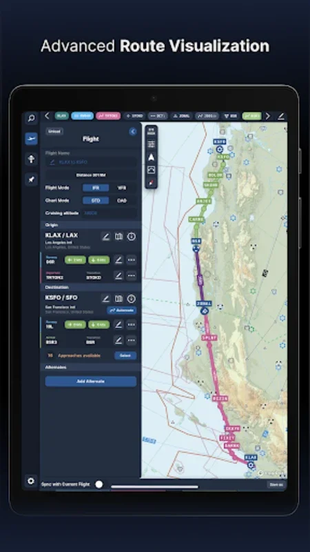
Synchronization Capabilities
The software beautifully synchronizes simulator sceneries, flight plans, navigation systems, and add - on software with consistent data from the same source. This creates a seamless and integrated flight simulation experience.
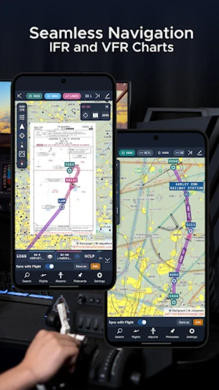
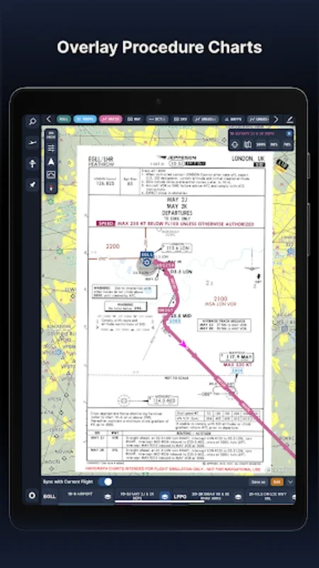
New Features in Navigraph Charts 8
The release of Navigraph Charts 8 brought several exciting new features. These include worldwide VFR Charts, seamless zoom, 3D globe projection, autopinning of procedure charts, and comprehensive weather information such as runway crosswind elements. The introduction of vector charts also enhanced the detail and clarity of navigational aids.
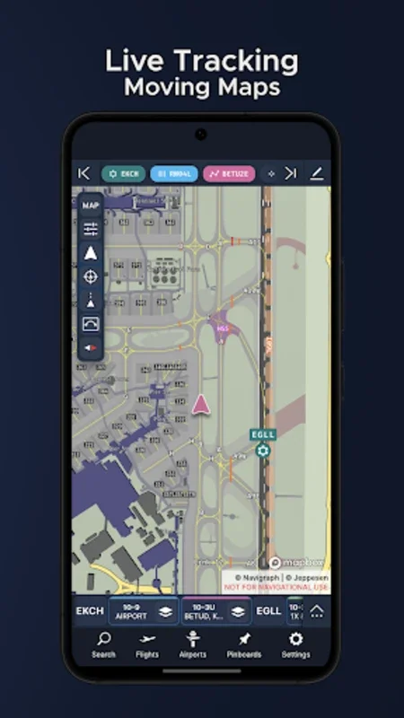
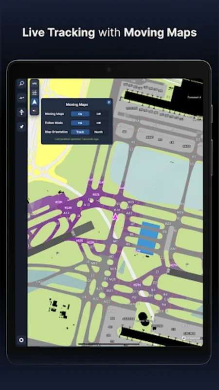
Navigraph Unlimited and Moving Maps
Navigraph Unlimited offers the Moving Maps feature, which extends capabilities to zoom down to gate level and provides real - time weather data. The no - commitment policy is an added convenience, allowing users to cancel whenever they want. The Moving Maps function is fully compatible with leading simulation platforms like Microsoft Flight Simulator, X - Plane, and Prepar3d.
Accessibility and Platform Support
To ensure an optimal user experience, using a tablet is recommended, and ongoing support for smaller displays is being developed. Navigraph Charts is available as standalone desktop software and can be accessed via any web browser, providing great flexibility in accessing its navigational resources.