Canada Maps App Introduction
Introduction
Canada Maps is an essential application for outdoor enthusiasts in Canada. It provides a wealth of features that make it a valuable tool for activities such as hiking, biking, climbing, skiing, and off - road adventures. This article will explore the various aspects of Canada Maps, including its mapping features, navigation capabilities, and additional utilities.
Mapping Features
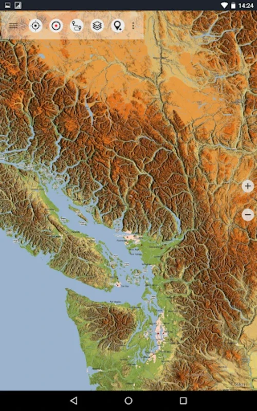
One of the standout features of Canada Maps is its access to detailed topographic maps. These maps are of high quality and are comparable to those found on traditional GPS devices. The application offers a variety of map layers, including satellite imagery from Google Maps and Bing Maps, road maps, and the detailed Open Street Maps. This allows users to toggle between different views depending on their needs.
In addition to the standard map layers, Canada Maps also includes enhancements such as Atlogis® hillshading and added place names. These features help users to better understand the terrain and navigate more effectively. The topographic data is sourced from the "© Department of Natural Resources Canada," ensuring its reliability and accuracy.
Navigation Capabilities
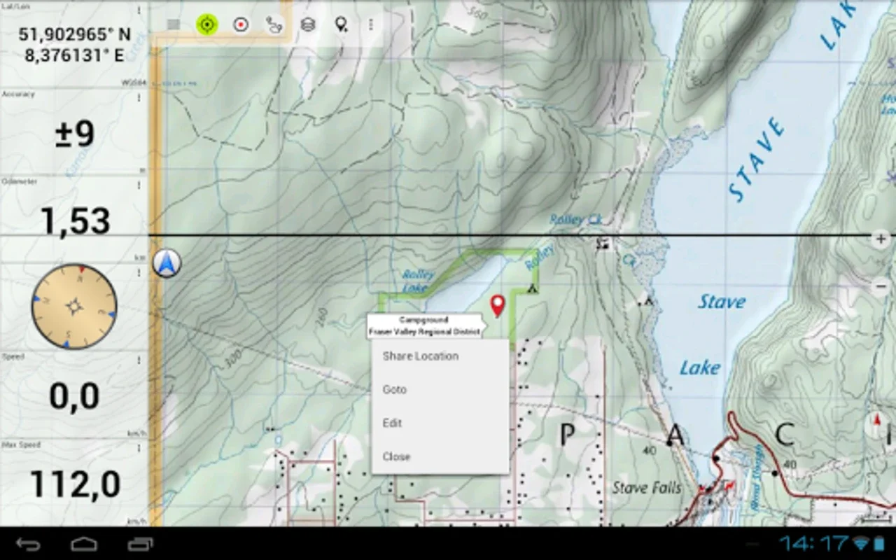
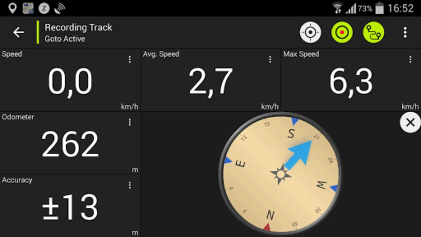
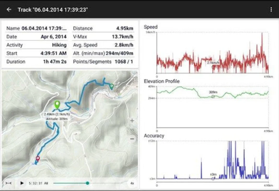
Canada Maps offers several useful navigation features. Users can preload map data for off - grid navigation, although this feature is only available in the paid version. However, even in the free version, users can still perform important navigation tasks such as pinpointing and saving waypoints, navigating directly to these points, and recording tracks. The tracks include information on speed, elevation, and accuracy, which can be useful for analyzing past trips.
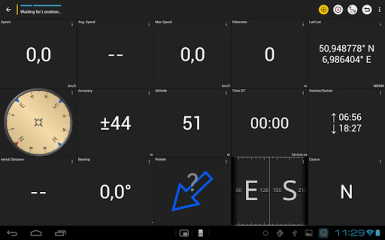
The Tripmaster feature is another useful tool for those who plan their outdoor excursions carefully. It offers data fields for odometer readings, average speed, bearing, elevation, and more. This allows users to keep track of their progress and plan their routes more effectively.
Additional Utilities
In addition to its mapping and navigation features, Canada Maps also offers several additional utilities. Users can import and export GPX files, export KML files, conduct searches for places of interest, and share waypoints and routes with others. These features make it easy for users to collaborate with others and share their outdoor experiences.
However, it should be noted that the free version of Canada Maps has some limitations. For example, it does not support the hillshading overlay, restricts the number of waypoints and tracks, and lacks some features like route navigation and local city database for offline search.
Conclusion
Overall, Canada Maps is a valuable tool for outdoor enthusiasts in Canada. It offers a wide range of features that make it useful for activities such as hiking, biking, climbing, skiing, and off - road adventures. While the free version has some limitations, the paid version offers even more functionality for those who need it. Whether you are exploring the mountains, forests, or other outdoor areas in Canada, Canada Maps can be an invaluable companion, especially in areas with limited cell service.