
Campi Flegrei App Introduction
Introduction
The Campi Flegrei region in Campania, Italy, is home to an active volcano that poses a significant threat to the over 600,000 residents in the area. The Campi Flegrei app has been developed to provide crucial information regarding the volcanic earthquakes in this region. This article will explore the various aspects of the app, its features, and its importance in enhancing awareness and preparedness among the people.
Understanding the Volcanic Activity in Campi Flegrei
The Campi Flegrei volcano has a long history of volcanic activity. It is essential to monitor the earthquakes associated with it as they can provide valuable insights into the potential eruption risk. The Vesuvius Observatory, through the National Institute of Geophysics and Volcanology, plays a vital role in collecting earthquake data. This data forms the basis for the information provided by the Campi Flegrei app.
Features of the Campi Flegrei App
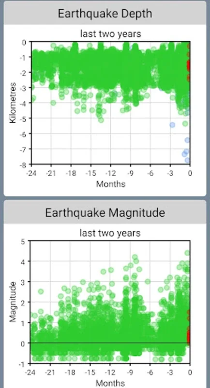
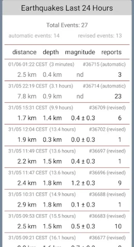
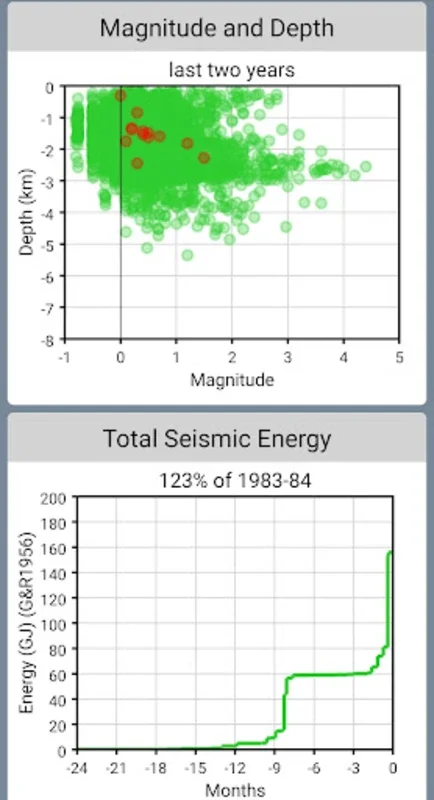
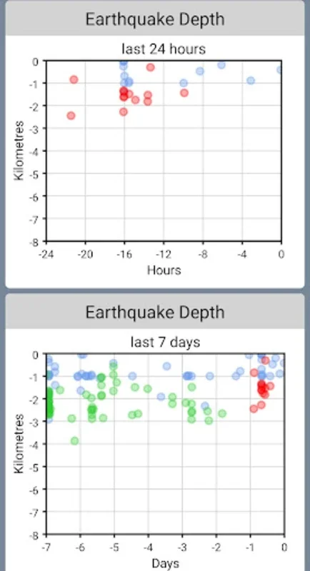
Visual Insights
The app generates visual representations of the earthquake data. It includes graphs that show the frequency, magnitude, and depth trends of the earthquakes. These visual aids are extremely helpful for users to quickly understand the patterns and changes in the seismic activity. For example, a sudden increase in the frequency of small - magnitude earthquakes could be an indication of a change in the volcanic activity.
Interactive Map
The interactive map is another significant feature of the app. It plots the epicentres of the earthquakes, the official hazard zones, and can also show the user's current location if they are in the vicinity. This allows for a more personalized experience and helps users to assess their proximity to the areas of potential danger. For instance, a visitor in the region can use the map to see if they are near an area with recent seismic activity.
The Significance of the Campi Flegrei App
For Residents
Residents of the Campi Flegrei area can use the app to stay informed about any changes in the volcanic activity. In case of an increase in seismic activity, they can take appropriate precautions. For example, they can be prepared to evacuate if the situation demands. The app gives them the power to monitor the situation and make informed decisions for their safety and that of their families.
For Visitors
Visitors to the region may not be aware of the volcanic risks. The Campi Flegrei app can serve as an educational tool for them. It can help them understand the potential hazards and enable them to plan their visit accordingly. For example, if there is a high level of seismic activity, they may choose to avoid certain areas.
How the Campi Flegrei App Differs from Other Volcano - Monitoring Tools
There are other tools available for monitoring volcanic activity. However, the Campi Flegrei app stands out in several ways. Firstly, its focus on the Campi Flegrei region makes it more specialized. It provides detailed and specific information about this particular volcano. Secondly, its user - friendly interface makes it accessible to a wide range of users, from those with no scientific background to volcanology experts.
The Future of the Campi Flegrei App
As technology advances, the Campi Flegrei app has the potential to be further enhanced. It could incorporate more advanced data analysis techniques to provide more accurate predictions of volcanic activity. It could also integrate with other emergency response systems in the region to ensure a more coordinated approach in case of a volcanic emergency.
Conclusion
The Campi Flegrei app is a crucial tool for monitoring the volcanic earthquakes in the Campi Flegrei region. It provides valuable information to both residents and visitors, enhancing their awareness and preparedness. With its unique features and potential for future development, it is set to play an even more significant role in the safety and well - being of those in the area of the Campi Flegrei volcano.